Roper Fire
201128,689 acresTexas
The Roper Fire burned 28,689 acres, about 45 square miles, across Brewster County. It began on April 11, 2011.
Watch how it happenedRoper Fire · 2011
How it happened
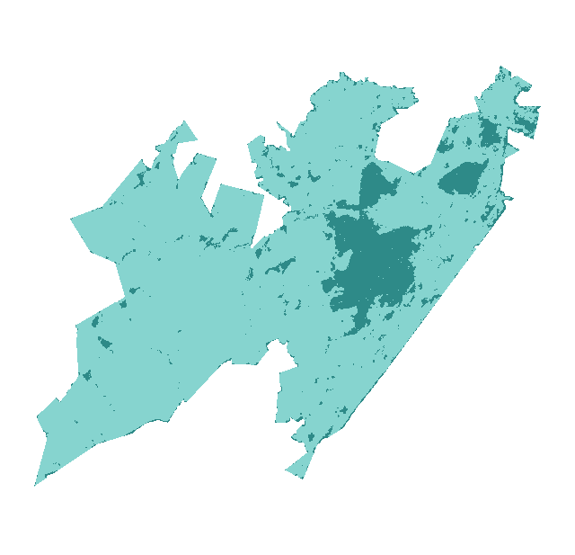
Watch it burn in the order satellites saw it, coloured by how severely each place burned.
How severely it burned
Burn severity inside the final perimeter, classified from Landsat images taken before and after the fire.
| Severity | Share | Acres |
|---|---|---|
| Lowsurface fire, most trees survive | 86% | 24,708 |
| Unburned to lowislands inside the perimeter, little change | 14% | 3,981 |
Most of the area inside the perimeter burned at low severity or not at all.
Monitoring Trends in Burn Severity (U.S. Geological Survey and USDA Forest Service). Classes come from the change in a Landsat burn index (dNBR) between images before and after the fire; acres are each class’s share of the fire’s mapped area.
Where it burned
Acres inside each county, measured from the satellite-mapped perimeter.
| Brewster County | TX | 28,699 |
Other large fires in Texas in 2011
- Rock House Fire299,011 acres
- Deaton Cole Fire167,650 acres
- Cooper Mountain Ranch Fire157,828 acres
- Wildcat Fire150,117 acres
- Swenson Fire136,718 acres
- Pk Complex128,450 acres
- Frying Pan Ranch Fire106,264 acres
- Dickens County Complex90,789 acres
Monitoring Trends in Burn Severity (USGS and U.S. Forest Service). Type recorded: Wildfire.