County Line 2 Fire
201568,167 acresOregon
The County Line 2 Fire burned 68,167 acres, about 107 square miles, across 2 counties. It began on August 12, 2015.
Watch how it happenedCounty Line 2 Fire · 2015
How it happened
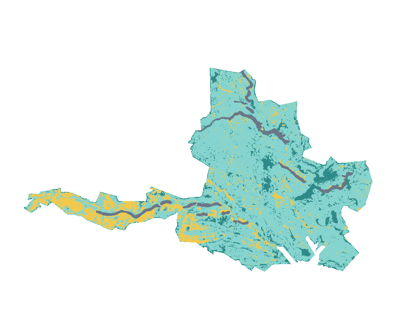
Watch it burn in the order satellites saw it, coloured by how severely each place burned.
How severely it burned
Burn severity inside the final perimeter, classified from Landsat images taken before and after the fire.
| Severity | Share | Acres |
|---|---|---|
| Moderatemixed: many trees killed, some survive | 12% | 8,343 |
| Lowsurface fire, most trees survive | 73% | 49,475 |
| Unburned to lowislands inside the perimeter, little change | 11% | 7,448 |
| Not mappedcloud, shadow or water in the satellite images | 4.2% | 2,885 |
No part of the fire was classed as high severity; 12% burned at moderate severity.
Monitoring Trends in Burn Severity (U.S. Geological Survey and USDA Forest Service). Classes come from the change in a Landsat burn index (dNBR) between images before and after the fire; acres are each class’s share of the fire’s mapped area.
Where it burned
Acres inside each county, measured from the satellite-mapped perimeter.
| Jefferson County | OR | 38,878 |
| Wasco County | OR | 29,315 |
Other large fires in Oregon in 2015
- Soda Fire282,664 acres
- Canyon Creek Complex109,753 acres
- Cornet-Windy Ridge Fire102,480 acres
- Butte Creek Fire79,362 acres
- Bendire Complex49,221 acres
- Corner Creek 0297 Pr Fire30,308 acres
- Unnamed Fire27,749 acres
- Stouts Creek Fire27,544 acres
Monitoring Trends in Burn Severity (USGS and U.S. Forest Service). Type recorded: Wildfire.