Oks - 283 Fire
201768,511 acresOklahoma
The Oks - 283 Fire burned 68,511 acres, about 107 square miles, across 2 counties. It began on March 7, 2017.
Watch how it happenedOks - 283 Fire · 2017
How it happened
Watch it burn in the order satellites saw it, coloured by how severely each place burned.
How severely it burned
Burn severity inside the final perimeter, classified from Landsat images taken before and after the fire.
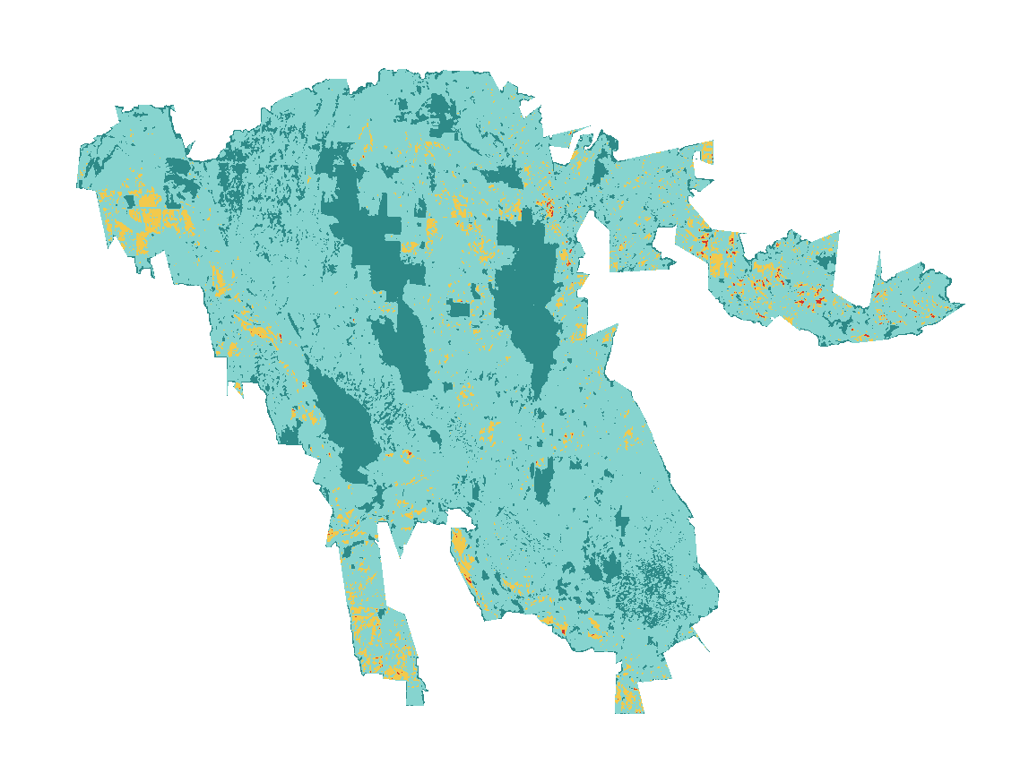
| Severity | Share | Acres |
|---|---|---|
| Highmost vegetation consumed, soils altered | 0.2% | 114 |
| Moderatemixed: many trees killed, some survive | 5.4% | 3,715 |
| Lowsurface fire, most trees survive | 76% | 51,848 |
| Unburned to lowislands inside the perimeter, little change | 19% | 12,833 |
under 1% of the area inside the perimeter burned at high severity, about 114 acres; 6% burned at moderate or high severity.
Monitoring Trends in Burn Severity (U.S. Geological Survey and USDA Forest Service). Classes come from the change in a Landsat burn index (dNBR) between images before and after the fire; acres are each class’s share of the fire’s mapped area.
Where it burned
Acres inside each county, measured from the satellite-mapped perimeter.
| Harper County | OK | 68,550 |
| Ellis County | OK | 7 |
Other large fires in Oklahoma in 2017
- Oks - Starbuck Fire656,868 acres
- Perryton Fire290,085 acres
- Oks - Selman Fire44,738 acres
Monitoring Trends in Burn Severity (USGS and U.S. Forest Service). Type recorded: Wildfire.