Tropical Storm Allison
Jun 5, 2001 to Jun 19, 2001Peak 58 mph1000 mb
Tropical Storm Allison passed within 50 miles of 31 counties in 4 states. It was strongest near Brazoria County, TX, as a tropical storm on June 5, 2001.
- Major hurricane
- Hurricane
- Tropical storm
- Post-tropical
Tropical Storm Allison · 2001
How it happened
Follow the storm’s path, strength and milestones.
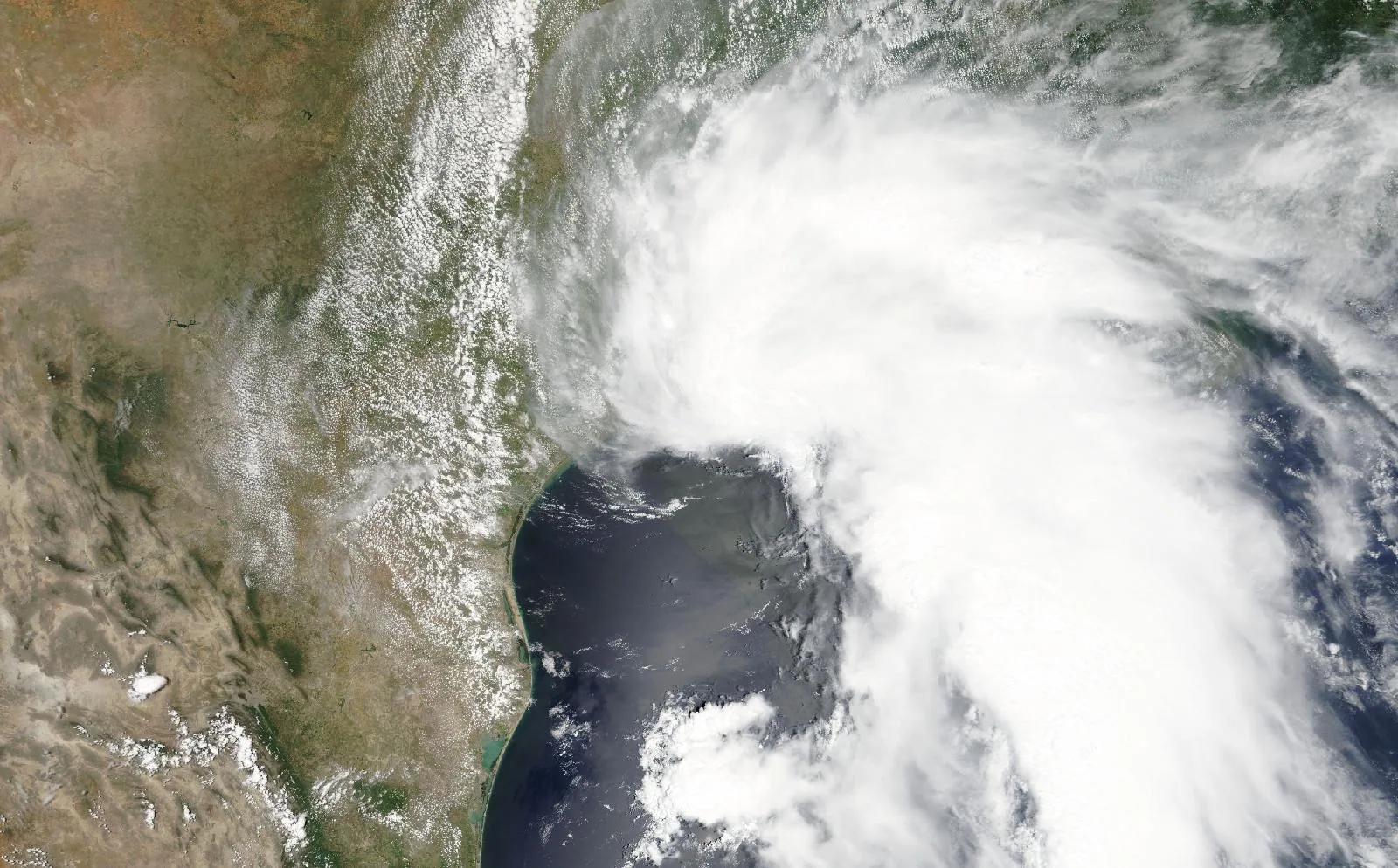
From space
Tropical Storm Allison on June 5, 2001, about 4 hours before landfall in Brazoria County, TX.
The storm
- Peak strength
- Tropical storm
- 58 mph, 50 kt
- Lowest pressure
- 1000 mb
- Over the whole track
- Counties within 50 miles
- 31
- AL, LA, MS, TX
- Counties within 100 miles
- 59
- AL, CT, LA, MS, NJ, NY, TX
- Landfalls recorded
- 2
- Anywhere on the track
Every county it passed
Closest approach to each county boundary, with the storm’s strength at that moment.
| St. Tammany Parish | LA | 0.0 | Subtropical storm |
| Brazoria County | TX | 0.0 | Tropical storm |
| Stone County | MS | 0.0 | Subtropical storm |
| Mobile County | AL | 0.0 | Subtropical storm |
| Pearl River County | MS | 0.0 | Subtropical storm |
| St. Charles Parish | LA | 0.0 | Subtropical storm |
| George County | MS | 0.0 | Subtropical storm |
| Harris County | TX | 0.0 | Tropical storm |
| St. John the Baptist Parish | LA | 1.5 | Subtropical storm |
| Greene County | MS | 1.5 | Subtropical storm |
| Tangipahoa Parish | LA | 1.6 | Subtropical storm |
| Galveston County | TX | 3.2 | Tropical storm |
| Jefferson Parish | LA | 3.3 | Subtropical storm |
| Hancock County | MS | 4.9 | Subtropical storm |
| Harrison County | MS | 5.0 | Subtropical storm |
| Orleans Parish | LA | 5.0 | Subtropical storm |
| Perry County | MS | 5.7 | Subtropical storm |
| Jackson County | MS | 8.0 | Subtropical storm |
| Forrest County | MS | 8.7 | Subtropical storm |
| Livingston Parish | LA | 13.9 | Subtropical storm |
| Ascension Parish | LA | 14.3 | Subtropical storm |
| Washington Parish | LA | 14.5 | Subtropical storm |
| St. Bernard Parish | LA | 18.9 | Subtropical storm |
| Lamar County | MS | 19.3 | Subtropical storm |
| Plaquemines Parish | LA | 24.0 | Subtropical storm |
| Marion County | MS | 25.8 | Subtropical storm |
| Walthall County | MS | 32.6 | Subtropical storm |
| St. Helena Parish | LA | 38.7 | Subtropical storm |
| Jones County | MS | 38.9 | Subtropical storm |
| Pike County | MS | 47.1 | Subtropical storm |
| Covington County | MS | 48.0 | Subtropical storm |
| Jefferson Davis County | MS | 51.7 | Subtropical storm |
| East Feliciana Parish | LA | 52.0 | Subtropical storm |
| Amite County | MS | 57.2 | Subtropical storm |
| Lawrence County | MS | 58.0 | Subtropical storm |
| Jasper County | MS | 63.9 | Subtropical storm |
| Monmouth County | NJ | 64.8 | Subtropical storm |
| Lincoln County | MS | 65.9 | Subtropical storm |
| Smith County | MS | 70.2 | Subtropical storm |
| Nassau County | NY | 74.8 | Subtropical storm |
| Wilkinson County | MS | 75.3 | Subtropical storm |
| Simpson County | MS | 75.4 | Subtropical storm |
| Franklin County | MS | 79.7 | Subtropical storm |
| Queens County | NY | 83.5 | Subtropical storm |
| Copiah County | MS | 84.3 | Subtropical storm |
| Middlesex County | NJ | 85.8 | Subtropical storm |
| Kings County | NY | 86.6 | Subtropical storm |
| Newton County | MS | 89.8 | Subtropical storm |
| Richmond County | NY | 92.0 | Subtropical storm |
| Rankin County | MS | 94.3 | Subtropical storm |
| Fairfield County | CT | 95.4 | Subtropical storm |
| Bronx County | NY | 96.8 | Subtropical storm |
| New York County | NY | 96.8 | Subtropical storm |
| Hudson County | NJ | 97.5 | Subtropical storm |
| Jefferson County | MS | 97.7 | Subtropical storm |
| Union County | NJ | 97.7 | Subtropical storm |
| Scott County | MS | 97.8 | Subtropical storm |
| Adams County | MS | 98.1 | Subtropical storm |
| Somerset County | NJ | 98.3 | Subtropical storm |
Distances are measured from hourly positions interpolated between the National Hurricane Center’s six-hourly fixes to each county boundary. Strength is shown only where the storm was still tropical. Methodology.
National Hurricane Center HURDAT2. Storm totals cover the Atlantic and Northeast and Central Pacific basins.