Tropical Storm Gabrielle
Sep 8, 2007 to Sep 11, 2007Peak 58 mph1004 mb
Tropical Storm Gabrielle passed within 50 miles of 20 counties in 2 states. It was strongest near Jones County, NC, as a tropical storm on September 9, 2007.
- Major hurricane
- Hurricane
- Tropical storm
- Post-tropical
Tropical Storm Gabrielle · 2007
How it happened
Follow the storm’s path, strength and milestones.
From space
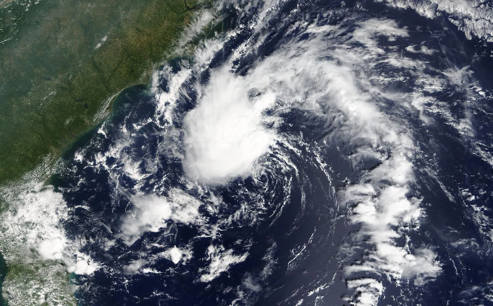
Tropical Storm Gabrielle on September 8, 2007, about 24 hours before landfall in Carteret County, NC.
The storm
- Peak strength
- Tropical storm
- 58 mph, 50 kt
- Lowest pressure
- 1004 mb
- Over the whole track
- Counties within 50 miles
- 20
- NC, VA
- Counties within 100 miles
- 50
- NC, VA
- Landfalls recorded
- 1
- Anywhere on the track
Every county it passed
Closest approach to each county boundary, with the storm’s strength at that moment.
| Dare County | NC | 0.0 | Tropical storm |
| Carteret County | NC | 0.0 | Tropical storm |
| Hyde County | NC | 0.0 | Tropical storm |
| Tyrrell County | NC | 4.5 | Tropical storm |
| Currituck County | NC | 5.4 | Tropical storm |
| Pamlico County | NC | 10.4 | Tropical storm |
| Camden County | NC | 13.1 | Tropical storm |
| Craven County | NC | 15.9 | Tropical storm |
| Pasquotank County | NC | 17.8 | Tropical storm |
| Beaufort County | NC | 18.4 | Tropical storm |
| Washington County | NC | 21.1 | Tropical storm |
| Perquimans County | NC | 23.1 | Tropical storm |
| Virginia Beach city | VA | 28.7 | Tropical storm |
| Chowan County | NC | 32.5 | Tropical storm |
| Jones County | NC | 37.5 | Tropical storm |
| Chesapeake city | VA | 39.3 | Tropical storm |
| Onslow County | NC | 40.1 | Tropical storm |
| Bertie County | NC | 43.0 | Tropical storm |
| Martin County | NC | 43.2 | Tropical storm |
| Gates County | NC | 44.8 | Tropical storm |
| Pitt County | NC | 50.5 | Tropical storm |
| Hertford County | NC | 53.5 | Tropical storm |
| Suffolk city | VA | 54.1 | Tropical storm |
| Norfolk city | VA | 55.2 | Tropical storm |
| Portsmouth city | VA | 57.5 | Tropical storm |
| Lenoir County | NC | 62.4 | Tropical storm |
| Pender County | NC | 63.7 | Tropical storm |
| Hampton city | VA | 66.4 | Tropical storm |
| Greene County | NC | 68.1 | Tropical storm |
| Newport News city | VA | 70.1 | Tropical storm |
| Isle of Wight County | VA | 71.4 | Tropical storm |
| Edgecombe County | NC | 72.0 | Tropical storm |
| Poquoson city | VA | 72.2 | Tropical storm |
| Duplin County | NC | 72.3 | Tropical storm |
| Southampton County | VA | 72.6 | Tropical storm |
| Halifax County | NC | 74.8 | Tropical storm |
| New Hanover County | NC | 74.8 | Tropical storm |
| York County | VA | 75.6 | Tropical storm |
| Franklin city | VA | 76.3 | Tropical storm |
| Northampton County | NC | 78.0 | Tropical storm |
| Wilson County | NC | 83.6 | Tropical storm |
| Wayne County | NC | 84.8 | Tropical storm |
| Surry County | VA | 86.2 | Tropical storm |
| James City County | VA | 87.2 | Tropical storm |
| Brunswick County | NC | 88.7 | Tropical storm |
| Greensville County | VA | 91.5 | Tropical storm |
| Sussex County | VA | 91.5 | Tropical storm |
| Williamsburg city | VA | 93.6 | Tropical storm |
| Sampson County | NC | 97.3 | Tropical storm |
| Nash County | NC | 97.4 | Tropical storm |
Distances are measured from hourly positions interpolated between the National Hurricane Center’s six-hourly fixes to each county boundary. Strength is shown only where the storm was still tropical. Methodology.
National Hurricane Center HURDAT2. Storm totals cover the Atlantic and Northeast and Central Pacific basins.