Tropical Storm Tammy
Oct 5, 2005 to Oct 7, 2005Peak 52 mph1001 mb
Tropical Storm Tammy passed within 50 miles of 40 counties in 2 states. It was strongest near Duval County, FL, as a tropical storm on October 6, 2005.
- Major hurricane
- Hurricane
- Tropical storm
- Post-tropical
Tropical Storm Tammy · 2005
How it happened
Follow the storm’s path, strength and milestones.
From space
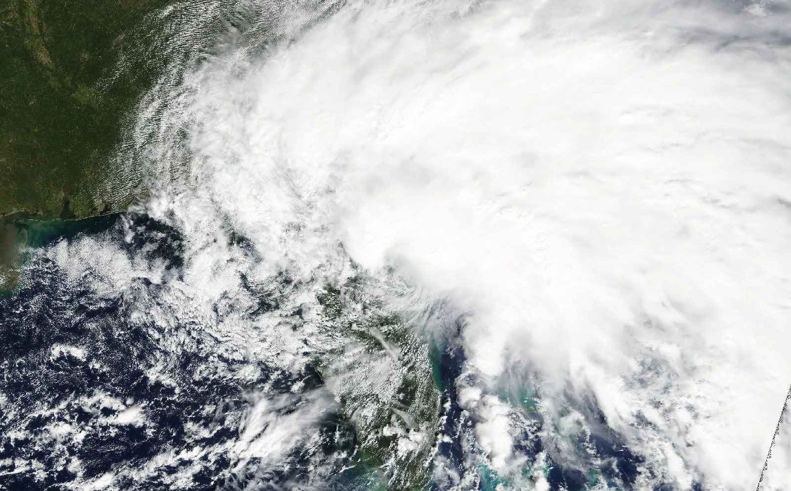
Tropical Storm Tammy on October 5, 2005, about 7 hours before landfall in Duval County, FL.
The storm
- Peak strength
- Tropical storm
- 52 mph, 45 kt
- Lowest pressure
- 1001 mb
- Over the whole track
- Counties within 50 miles
- 40
- FL, GA
- Counties within 100 miles
- 68
- FL, GA
- Landfalls recorded
- 1
- Anywhere on the track
Every county it passed
Closest approach to each county boundary, with the storm’s strength at that moment.
| Duval County | FL | 0.0 | Tropical storm |
| Charlton County | GA | 0.0 | Tropical storm |
| Nassau County | FL | 0.0 | Tropical storm |
| Atkinson County | GA | 0.0 | Tropical storm |
| Ware County | GA | 0.0 | Tropical storm |
| Clinch County | GA | 4.4 | Tropical storm |
| St. Johns County | FL | 5.3 | Tropical storm |
| Camden County | GA | 7.1 | Tropical storm |
| Brantley County | GA | 8.7 | Tropical storm |
| Brevard County | FL | 11.7 | Tropical storm |
| Flagler County | FL | 12.8 | Tropical storm |
| Lanier County | GA | 12.9 | Tropical storm |
| Volusia County | FL | 13.2 | Tropical storm |
| Pierce County | GA | 14.2 | Tropical storm |
| Bacon County | GA | 16.7 | Tropical storm |
| Baker County | FL | 18.7 | Tropical storm |
| Clay County | FL | 21.9 | Tropical storm |
| Echols County | GA | 25.2 | Tropical storm |
| Indian River County | FL | 26.3 | Tropical storm |
| Putnam County | FL | 26.4 | Tropical storm |
| Columbia County | FL | 26.7 | Tropical storm |
| St. Lucie County | FL | 28.3 | Tropical storm |
| Martin County | FL | 29.2 | Tropical storm |
| Orange County | FL | 30.4 | Tropical storm |
| Glynn County | GA | 30.9 | Tropical storm |
| Seminole County | FL | 31.4 | Tropical storm |
| Wayne County | GA | 31.6 | Tropical storm |
| Appling County | GA | 32.4 | Tropical storm |
| Palm Beach County | FL | 32.6 | Tropical storm |
| Hamilton County | FL | 34.7 | Tropical storm |
| Osceola County | FL | 34.8 | Tropical storm |
| Bradford County | FL | 36.4 | Tropical storm |
| Union County | FL | 39.5 | Tropical storm |
| Lake County | FL | 40.8 | Tropical storm |
| Wheeler County | GA | 43.7 | Tropical storm |
| Marion County | FL | 45.5 | Tropical storm |
| Okeechobee County | FL | 47.7 | Tropical storm |
| Montgomery County | GA | 48.0 | Tropical storm |
| Toombs County | GA | 49.8 | Tropical storm |
| McIntosh County | GA | 49.9 | Tropical storm |
| Suwannee County | FL | 52.4 | Tropical storm |
| Long County | GA | 53.9 | Tropical storm |
| Tattnall County | GA | 54.2 | Tropical storm |
| Alachua County | FL | 55.2 | Tropical storm |
| Liberty County | GA | 67.5 | Tropical storm |
| Polk County | FL | 68.9 | Tropical storm |
| Glades County | FL | 69.9 | Tropical storm |
| Highlands County | FL | 71.2 | Tropical storm |
| Broward County | FL | 71.5 | Tropical storm |
| Evans County | GA | 72.4 | Tropical storm |
| Lafayette County | FL | 73.4 | Tropical storm |
| Emanuel County | GA | 73.4 | Tropical storm |
| Sumter County | FL | 73.7 | Tropical storm |
| Gilchrist County | FL | 73.9 | Tropical storm |
| Hendry County | FL | 76.3 | Tropical storm |
| Taylor County | FL | 77.4 | Tropical storm |
| Candler County | GA | 77.9 | Tropical storm |
| Bryan County | GA | 80.4 | Tropical storm |
| Levy County | FL | 81.9 | Tropical storm |
| Bulloch County | GA | 82.8 | Tropical storm |
| Chatham County | GA | 83.3 | Tropical storm |
| Dixie County | FL | 84.5 | Tropical storm |
| Citrus County | FL | 90.5 | Tropical storm |
| Hernando County | FL | 93.0 | Tropical storm |
| Effingham County | GA | 94.2 | Tropical storm |
| Pasco County | FL | 94.4 | Tropical storm |
| Hardee County | FL | 94.5 | Tropical storm |
| Miami-Dade County | FL | 95.1 | Tropical storm |
Distances are measured from hourly positions interpolated between the National Hurricane Center’s six-hourly fixes to each county boundary. Strength is shown only where the storm was still tropical. Methodology.
National Hurricane Center HURDAT2. Storm totals cover the Atlantic and Northeast and Central Pacific basins.