Hurricane Rita
Sep 18, 2005 to Sep 26, 2005Peak 178 mph895 mb
Hurricane Rita passed within 50 miles of 39 counties in 3 states. It was strongest near Iberia Parish, LA, as a Category 3 on September 24, 2005.
- Major hurricane
- Hurricane
- Tropical storm
- Post-tropical
Hurricane Rita · 2005
How it happened
Follow the storm’s path, strength and milestones.
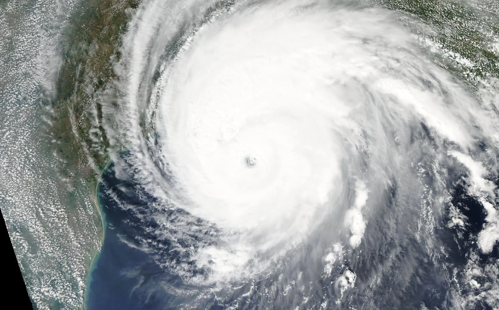
From space
Hurricane Rita on September 23, 2005, about 12 hours before landfall in Cameron Parish, LA.
The storm
- Peak strength
- Category 5
- 178 mph, 155 kt
- Lowest pressure
- 895 mb
- Over the whole track
- Counties within 50 miles
- 39
- FL, LA, TX
- Counties within 100 miles
- 70
- FL, LA, TX
- Landfalls recorded
- 1
- Anywhere on the track
Every county it passed
Closest approach to each county boundary, with the storm’s strength at that moment.
| Shelby County | TX | 0.0 | Tropical storm |
| Tyler County | TX | 0.0 | Tropical storm |
| Caddo Parish | LA | 0.0 | Tropical storm |
| San Augustine County | TX | 0.0 | Tropical storm |
| Hardin County | TX | 0.0 | Category 1 |
| Cameron Parish | LA | 0.0 | Category 3 |
| Orange County | TX | 0.0 | Category 2 |
| Jasper County | TX | 0.0 | Category 1 |
| Panola County | TX | 0.0 | Tropical storm |
| Jefferson County | TX | 1.4 | Category 2 |
| De Soto Parish | LA | 2.3 | Tropical storm |
| Marion County | TX | 2.6 | Tropical storm |
| Harrison County | TX | 2.6 | Tropical storm |
| Sabine County | TX | 3.3 | Tropical storm |
| Angelina County | TX | 3.8 | Tropical storm |
| Cass County | TX | 6.4 | Tropical storm |
| Newton County | TX | 7.8 | Category 1 |
| Calcasieu Parish | LA | 9.5 | Category 2 |
| Nacogdoches County | TX | 12.1 | Tropical storm |
| Sabine Parish | LA | 12.5 | Tropical storm |
| Beauregard Parish | LA | 17.0 | Category 1 |
| Rusk County | TX | 22.1 | Tropical storm |
| Red River Parish | LA | 25.3 | Tropical storm |
| Polk County | TX | 26.1 | Category 1 |
| Liberty County | TX | 29.6 | Category 1 |
| Vernon Parish | LA | 31.1 | Tropical storm |
| Chambers County | TX | 31.4 | Category 1 |
| Gregg County | TX | 32.1 | Tropical storm |
| Monroe County | FL | 35.3 | Category 3 |
| Bienville Parish | LA | 35.5 | Tropical storm |
| Natchitoches Parish | LA | 36.9 | Tropical storm |
| Morris County | TX | 40.0 | Tropical storm |
| Galveston County | TX | 40.1 | Category 3 |
| Upshur County | TX | 40.2 | Tropical storm |
| San Jacinto County | TX | 43.5 | Category 1 |
| Camp County | TX | 44.1 | Tropical storm |
| Trinity County | TX | 44.3 | Tropical storm |
| Cherokee County | TX | 45.4 | Tropical storm |
| Jefferson Davis Parish | LA | 48.0 | Category 3 |
| Houston County | TX | 50.6 | Tropical storm |
| Allen Parish | LA | 51.0 | Category 1 |
| Titus County | TX | 51.4 | Tropical storm |
| Smith County | TX | 54.7 | Tropical storm |
| Vermilion Parish | LA | 56.6 | Category 3 |
| Harris County | TX | 63.1 | Category 1 |
| Montgomery County | TX | 63.7 | Category 1 |
| Winn Parish | LA | 65.0 | Tropical storm |
| Grant Parish | LA | 65.4 | Tropical storm |
| Rapides Parish | LA | 66.2 | Tropical storm |
| Wood County | TX | 66.6 | Tropical storm |
| Anderson County | TX | 68.2 | Tropical storm |
| Franklin County | TX | 69.3 | Tropical storm |
| Acadia Parish | LA | 70.0 | Category 3 |
| Jackson Parish | LA | 71.7 | Tropical storm |
| Walker County | TX | 72.8 | Tropical storm |
| Hopkins County | TX | 78.1 | Tropical storm |
| Evangeline Parish | LA | 80.1 | Category 2 |
| Henderson County | TX | 80.2 | Tropical storm |
| Van Zandt County | TX | 82.7 | Tropical storm |
| Iberia Parish | LA | 85.9 | Category 3 |
| Brazoria County | TX | 87.4 | Category 1 |
| St. Landry Parish | LA | 87.6 | Category 2 |
| Madison County | TX | 89.7 | Tropical storm |
| Lafayette Parish | LA | 90.6 | Category 3 |
| Leon County | TX | 92.0 | Tropical storm |
| Miami-Dade County | FL | 93.1 | Category 1 |
| Rains County | TX | 95.1 | Tropical storm |
| Fort Bend County | TX | 98.1 | Category 1 |
| St. Mary Parish | LA | 98.6 | Category 3 |
| Freestone County | TX | 99.3 | Tropical storm |
Distances are measured from hourly positions interpolated between the National Hurricane Center’s six-hourly fixes to each county boundary. Strength is shown only where the storm was still tropical. Methodology.
National Hurricane Center HURDAT2. Storm totals cover the Atlantic and Northeast and Central Pacific basins.